 March 26, 2021 DWR Adjusts State Water Project Allocation As California experiences a second consecutive dry year, the Department of Water Resources (DWR) has announced an adjustment to its initial State Water Project (SWP) allocation for the 2021 water year. The Department now expects the SWP to deliver 5 percent of requested supplies this year, down from the initial allocation of 10 percent announced in December. Allocations represent the amount of SWP water that DWR will deliver to 27 million Californians and 750,000 acres of farmland for the year and are reviewed monthly based on several factors, such as water in storage, environmental requirements, and rain and snowmelt runoff projections. Drought conditions have a significant impact on the state’s water supply. Lake Oroville storage is only at 53 percent of its historical average. Beginning April 1, outflows to the Feather River will be further reduced to conserve storage while maintaining the Feather River flows necessary for fishery, environmental, and water delivery needs. More information is available in the March 23 DWR News Release. Reducing Climate Change Impacts at Thermalito Powerplant An old electricity-generating turbine at the Ronald B. Robie Thermalito Pumping-Generating Powerplant (Thermalito Powerplant) has been replaced with a new energy efficient model that will help DWR achieve its goal of using 100 percent zero-emission resources by 2045. The new Kaplan turbine allows more clean hydropower to be generated from the same water releases and deliveries, an increase in efficiency from 86 percent to 93 percent, providing even more clean energy to California’s electrical grid. It will also reduce greenhouse gas emissions by nearly 1,000 metric tons per year, helping DWR further reduce its carbon footprint. The Thermalito turbine project is partially funded by California Climate Investments, a statewide initiative that puts billions of cap-and-trade dollars to work. Learn more about how the new turbine at the Thermalito Powerplant is helping California meet its clean energy goals by watching our new video and reading the latest DWR Update. For more information on DWR’s renewable energy initiatives, visit our clean energy webpage. Photo: New Kaplan turbine (foreground) at the restored Ronald B. Robie Thermalito Pumping-Generating Powerplant 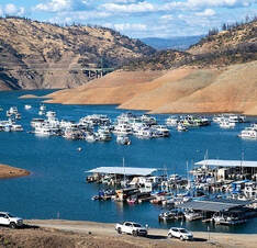 Goats to Remove Vegetation Near Diversion Pool Approximately five acres at Lakeland Boulevard will benefit from hazardous fuels reduction through DWR’s partnership with the Butte County Fire Safe Council (BCFSC). Around 350 to 400 goats will graze an area southeast of the Thermalito Diversion Pool and the Thermalito Diversion Dam during the week of March 28. The goats will graze on grasses, leaves, invasive and non-invasive plants including poison oak, and a variety of shrubs and trees. The grazing area will be cordoned off with an electric fence and monitored by herders and livestock guardian dogs to protect the animals. The public is urged to stay clear of the electric fence and keep pets away, so the goats are not disturbed. This work is part of DWR’s Fuel Load Management Program, which was started in 2012 to reduce hazardous fuels within the Federal Energy Regulatory Commission (FERC) project boundary. DWR, along with partners CAL FIRE, the California Conservation Corps, BCFSC, Butte County Sheriff’s Office, and California Department of State Parks and Recreation (CA Parks), are all working together to accomplish the same common goal -- reduce wildfire risk, increase public safety, and enhance forest health in areas around Lake Oroville. To date, approximately 675 acres have been treated around the Lake Oroville area by DWR and its partners. Photo: Goats perform fuel reduction grazing near Lake Oroville's Lime Saddle Recreation Area in 2019 Trail Closure at Loafer Creek A one-mile portion of the Roy Rogers Trail in the Loafer Creek Recreation Area will be closed Monday through Friday starting March 22 and extending to April 30, as work crews will be cutting vegetation in this area. The four-mile equestrian and hiking trail will be fully open Saturdays and Sundays only. DWR and CA Parks are partnering with CAL FIRE’s Vegetation Management Program to clear hazard trees and fire-prone underbrush from the North Complex Wildfire burn scar in the Loafer Creek Recreation Area. CAL FIRE work crews will hand cut and use heavy equipment in the northeastern portion of Loafer Creek; crews may be visible or audible to visitors in the Recreation Area. This collaborative effort to aid in recovery from impacts caused by the 2020 North Complex wildfire will continue for the next several years. 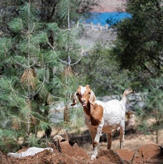 Oroville Recreation Many Lake Oroville State Recreation Area (LOSRA) campgrounds are open. Reservations for camp sites can be made online for dates after April 1 by selecting the Reservations tab on the Lake Oroville State Recreation Area webpage. Group camping, including floating campgrounds, and boat-in campgrounds remain closed. The Lime Saddle, Bidwell Canyon, and Spillway boat ramps are open for use. Bidwell Canyon and Lime Saddle boat ramps are open 24-hours per day and the Spillway boat ramp is open from 6 a.m. to 8 p.m. daily. The Loafer Creek boat ramps remain out of the water. The Loafer Point Boat Ramp area is still closed for construction which is anticipated to be completed this spring. All day use facilities at Lake Oroville State Recreation Area (LOSRA) are open. The Lake Oroville Visitor Center remains closed due to COVID-19 restrictions. Visit the California Parks LOSRA webpage for current information on facility status as well as current requirements to protect public health during the COVID-19 pandemic. Information about recreation facilities can be found in DWR’s interactive map on the Lake Oroville Recreation webpage. For information about the Oroville Wildlife Area, including the Thermalito Afterbay, visit the California Department of Fish and Wildlife webpage. Photo: Horseback riding on the Sewim Bo Trail near Old Ferry Road in Oroville Current Lake Operations The elevation of Oroville’s reservoir is about 720 feet elevation and storage is about 1.41 million acre-feet -- 40 percent full and 53 percent of historical average. Currently, in the Northern Sierra Basin, rainfall is below average, at 53 percent of normal for this time of year and snowpack is also below average at 71 percent of normal. Dry conditions with a warming trend are expected this weekend and into the week of March 29. The total releases to the Feather River are 1,050 cubic feet per second (cfs). During the first week of April, DWR is planning to further decrease total flows to the Feather River to conserve water this spring until it is needed later in the season for downstream flow, supply, and water quality requirements. Currently, the Feather River flows consist of 800 cfs down the Low Flow Channel through the City of Oroville, and 250 cfs from the Thermalito Afterbay Outlet (Outlet) for a total of 1,050 cfs for the Feather River’s high flow channel downstream of the Outlet. The public can track precipitation, snow, reservoir levels, and more at the California Data Exchange Center at www.cdec.water.ca.gov. Lake Oroville is identified as “ORO”. All data as of midnight 3/25/2021 ### Know someone who would like to receive Community Updates? They can email their request to [email protected]. 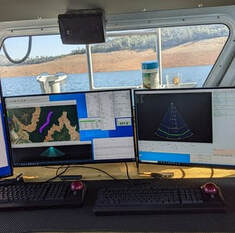 March 19, 2021 Trail Closure at Loafer Creek A one-mile portion of the Roy Rogers Trail in the Loafer Creek Recreation Area will be closed Monday through Friday starting March 22 and extending to April 30. The four-mile equestrian and hiking trail will be fully open Saturdays and Sundays only. The Department of Water Resources (DWR) and California State Parks (CA Parks) are partnering with CAL FIRE’s Vegetation Management Program to clear hazard trees and fire-prone underbrush from the North Complex Wildfire burn scar in the Loafer Creek Recreation Area. CAL FIRE work crews will hand cut and use heavy equipment in the northeastern portion of Loafer Creek; crews may be visible or audible to visitors in the Recreation Area. This collaborative effort to aid in recovery from impacts caused by the 2020 North Complex wildfire will continue for the next several years. Temporary Closure of Brad Freeman Trail A small section of the Brad Freeman Trail near the Thermalito Diversion Pool across from Oroville Dam’s main spillway will be closed Monday, March 22 through Thursday, March 25 for electrical work. Signage directing trail users to a temporary trail around the closure have been installed. Temporary Closure Protects Eaglet A section of the Wyandotte Campground in the Plumas National Forest is temporarily closed to protect a bald eagle nesting territory in the vicinity of Little Grass Valley Reservoir northeast of Oroville. The remainder of the campground is not affected by the closure which is in effect until July 15, 2021. The closure has been in effect for almost two decades and has helped a bald eagle pair to successfully nest and raise young, contributing to the sustained recovery for this species. Bald eagles are particularly sensitive to disturbances during their nesting phase. Information about the closure may be found on the U.S. Forest Service website at https://www.fs.usda.gov/alerts/plumas/alerts-notices. Photo: Bald Eagle and eaglet in Plumas Nat’l Forest territory May 2018 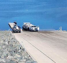 Oroville Recreation The Lake Oroville State Recreation Area (LOSRA) campgrounds at Bidwell Canyon, Loafer Creek (including the Equestrian Campground), and the Lime Saddle Campground are open. Group camping, including floating campgrounds, and boat-in campgrounds remain closed. Reservation capability does not open until April and camping sites will be allocated on a ‘first come-first serve’ basis. The Lime Saddle, Bidwell Canyon, and Spillway boat ramps are open for use. Bidwell Canyon and Lime Saddle boat ramps are open 24-hours per day and the Spillway boat ramp is open from 6 a.m. to 8 p.m. daily. The Loafer Creek boat ramps remain out of the water. The Loafer Point Boat Ramp area is still closed for construction which is anticipated to be completed this spring. All day use facilities at Lake Oroville State Recreation Area (LOSRA) are open. The Lake Oroville Visitor Center remains closed. Visit the California Parks LOSRA webpage for current information on facility status as well as current requirements to protect public health during the COVID-19 pandemic. Information about recreation facilities can be found in DWR’s interactive map on the Lake Oroville Recreation webpage. For information about the Oroville Wildlife Area, including the Thermalito Afterbay, visit the California Department of Fish and Wildlife webpage. Photo: Sailing on Lake Oroville Current Lake Operations The elevation of Oroville’s reservoir is about 716 feet elevation and storage is about 1.38 million acre-feet -- 39 percent full and 53 percent of historical average. Currently, in the Northern Sierra Basin, rainfall is below average, at 54 percent of normal for this time of year and snowpack is also below average at 68 percent of normal. Dry conditions are forecasted for the weekend and into the week of March 22. The total releases to the Feather River are 1,050 cubic feet per second (cfs) to conserve storage in Lake Oroville. The Feather River flows will consist of 800 cfs down the Low Flow Channel through the City of Oroville, and 250 cfs from the Thermalito Afterbay Outlet (Outlet) for a total of 1,050 cfs for the Feather River’s high flow channel downstream of the Outlet. The public can track precipitation, snow, reservoir levels, and more at the California Data Exchange Center at www.cdec.water.ca.gov. Lake Oroville is identified as “ORO”. All data as of midnight 3/18/2021 ### Know someone who would like to receive Community Updates? They can email their request to [email protected].  March 12, 2021 Monument Hill Facility Improvements at the Monument Hill Boat Ramp and Day Use Area’s boat ramp and beach have been completed. The Department of Water Resources (DWR) placed 45 cubic yards of sand on the public beach, repaired storm erosion, and corrected movement of the boarding float at the boat launch. The Monument Hill facility on the Thermalito Afterbay is off Highway 162 near State Route 99. The Thermalito Afterbay, part of the Department’s Oroville-Thermalito Complex, is a large water supply and hydropower generation reservoir in the Oroville Wildlife Area (OWA). The California Department of Fish and Wildlife (CDFW) manages the wildlife resources of the OWA for DWR. Photo: Laying new sand for Monument Hill Day Use Area beach Reopening Additional Area at Thermalito Diversion Pool During the recovery from the 2017 Oroville Spillways Incident, the exclusion zone and buoy line in the Thermalito Diversion Pool below Oroville Dam was temporarily extended approximately one-half-mile downstream. The exclusion zone has been reduced and the buoy line moved back upstream to its historical location just below the spillway, reopening additional area for public access. The Thermalito Diversion Pool provides opportunity for non-motorized water sports including kayaking, canoeing, and swimming. A car-top boat launch is available off of Cherokee Road. The upper end of the Diversion Pool near the spillway and dam, while open for fishing from the southern shoreline, excludes watersports, including swimming, wading, and paddle sports. Access to this area is available from the Brad Freeman Trail as well as from the new parking area off Oro Powerhouse Road (Oroville Dam Boulevard East towards Kelly Ridge, turn onto Oro Powerhouse Road and make immediate left before reaching the Hyatt Powerplant entrance gate).  Oroville Recreation The Lake Oroville State Recreation Area (LOSRA) campgrounds at Bidwell Canyon, Loafer Creek – including the Equestrian Campground, and the Lime Saddle Campground are open. Group camping, including floating campgrounds, and boat-in campgrounds remain closed. Reservation capability does not open until April and camping sites will be allocated on a ‘first come-first serve’ basis. The Lime Saddle, Bidwell Canyon, and Spillway boat ramps are open for use. Bidwell Canyon and Lime Saddle boat ramps are open 24-hours per day and the Spillway boat ramp is open from 6 a.m. to 8 p.m. daily. The Loafer Creek boat ramps remain out of the water. The Loafer Point Boat Ramp area is still closed for construction which is anticipated to be completed this spring. All day use facilities at Lake Oroville State Recreation Area (LOSRA) are open. The Lake Oroville Visitor Center remains closed. Visit the California Parks LOSRA webpage for current information on facility status as well as current requirements to protect public health during the COVID-19 pandemic. Information about recreation facilities can be found in DWR’s interactive map on the Lake Oroville Recreation webpage. For information about the Oroville Wildlife Area, including the Thermalito Afterbay, visit the California Department of Fish and Wildlife webpage. Photo: Sailing on Lake Oroville Current Lake Operations The elevation of Oroville’s reservoir is about 714 feet elevation and storage is about 1.37 million acre-feet -- 39 percent full and 54 percent of historical average. Currently, in the Northern Sierra Basin, rainfall is below average, at 52 percent of normal for this time of year and snowpack is also below average at 64 percent of normal. Around half an inch of precipitation is expected in the Feather River basin Sunday into Monday with dry conditions forecasted for the remainder of the week of March 15. The total releases to the Feather River are 1,050 cubic feet per second (cfs) to conserve storage in Lake Oroville. The Feather River flows will consist of 800 cfs down the Low Flow Channel through the City of Oroville, and 250 cfs from the Thermalito Afterbay Outlet (Outlet) for a total of 1,050 cfs for the Feather River’s high flow channel downstream of the Outlet. The public can track precipitation, snow, reservoir levels, and more at the California Data Exchange Center at www.cdec.water.ca.gov. Lake Oroville is identified as “ORO”. All data as of midnight 3/11/2021 ### Know someone who would like to receive Community Updates? They can email their request to [email protected]. 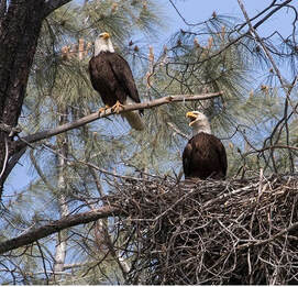 March 5, 2021 Reopening Additional Area at Thermalito Diversion Pool During the recovery from the 2017 Oroville Spillways Incident, the exclusion zone and buoy line in the Thermalito Diversion Pool below Oroville Dam was temporarily extended approximately one-half-mile downstream. This week, the exclusion zone has been reduced and the buoy line moved back upstream to its historical location just below the spillway, reopening additional area for public access. The Thermalito Diversion Pool provides opportunity for non-motorized water sports including kayaking, canoeing, and swimming. A car-top boat launch is available off of Cherokee Road. The upper end of the Diversion Pool near the spillway and dam, while open for fishing from the southern shoreline, excludes watersports, including swimming, wading, and paddle sports. Access to this area is available from the Brad Freeman Trail as well as from the new parking area off Oro Powerhouse Road (Oroville Dam Boulevard East towards Kelly Ridge, turn onto Oro Powerhouse Road and make immediate left before reaching the Hyatt Powerplant entrance gate). Water Wednesday Focus on the Feather River Watershed The Department of Water Resources Water Wednesday program just completed a series of episodes on watershed health, including a focus on the Feather River watershed that drains into Lake Oroville. Four February episodes discussed how a watershed works; wildfire impacts on watersheds and water quality; how DWR staff work to protect sensitive environments and species; and the anticipated impacts climate change may have on California’s watersheds. Water Wednesday episodes, started in 2020 to provide online, interactive education to students, cover a wide range of ‘water-oriented’ topics of interest to many viewers and are available on DWR’s YouTube page.  Oroville Recreation The Lake Oroville State Recreation Area (LOSRA) campgrounds at Bidwell Canyon, Loafer Creek – including the Equestrian Campground, and the Lime Saddle Campground are open. Group camping, including floating campgrounds, and boat-in campgrounds remain closed. Reservation capability does not open until April and camping sites will be allocated on a ‘first come-first serve’ basis. The Potters Ravine and North Fork trails are open for use. CA Parks encourages users to remain on the trails. Assessments by CA Parks staff of trail safety are ongoing. All day use facilities at Lake Oroville State Recreation Area (LOSRA) are open. The Lake Oroville Visitor Center remains closed. Visit the California Parks LOSRA webpage for current information on facility status as well as current requirements to protect public health during the COVID-19 pandemic. Information about recreation facilities can be found in DWR’s interactive map on the Lake Oroville Recreation webpage. For information about the Oroville Wildlife Area, including the Thermalito Afterbay, visit the California Department of Fish and Wildlife webpage. Photo: Hiking along the Thermalito Diversion Pool on the Brad Freeman Trail Lake Oroville Boat Ramps The Lime Saddle, Bidwell Canyon, and Spillway boat ramps are open for use. Bidwell Canyon and Lime Saddle boat ramps are open 24-hours per day and the Spillway boat ramp is open from 6 a.m. to 8 p.m. daily. The Lake Oroville Marina at Lime Saddle is open 8 a.m. to 4:30 p.m. and the Bidwell Canyon Marina is open 7 a.m. to 8 p.m. The Loafer Creek boat ramps remain out of the water. The Loafer Point Boat Ramp area is still closed for construction which is anticipated to be completed this spring. 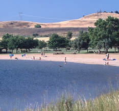 Bald Eagles Build New Nest A nesting pair of bald eagles that lost their nest tree in the North Complex Fire have returned. Environmental scientists with the Department of Water Resources have located a newly built nest in an undamaged tree within their territory and observed nesting activity on the new nest by the pair. Lake Oroville and the Feather River area provide ideal habitat for bald eagles. Fish are one of the eagles’ main food sources and large water bodies like Lake Oroville provide a wide variety of fish as well as other favorite food sources such as waterfowl, small birds, and mammals. The many trees and snags (tall dead trees) near water areas provide prime nesting, roosting, and hunting locations. Protecting the area’s year-round bald eagle population living in the Department of Water Resources’ (DWR) Oroville-Thermalito Complex jurisdiction is the responsibility of the Oroville Field Division’s Environmental Scientists. The bald eagle is a protected species under the Migratory Bird Treaty Act of 1918 and Bald and Golden Eagle Protection Act of 1940. They were listed as an endangered species in 1978. Those protections have been successful, and the species is now federally delisted. DWR’s scientists monitor for and, if necessary, act against threats such as public intrusions, habitat loss, or other impacts to the eagles’ nesting areas. Photo: Bald eagle nest in unburned tree near North Complex Wildfire burn scar - inside red circle Current Lake Operations The elevation of Oroville’s reservoir is about 713 feet elevation and storage is about 1.35 million acre-feet - 38 percent full and 54 percent of historical average. Currently, in the Northern Sierra Basin, rainfall is below average, at 49 percent of normal for this time of year and snowpack is also below average at 61 percent of normal. A break in the rain this weekend with continuing chance of rain and colder temperatures in the early part of the week of March 8. The total releases to the Feather River are 1,050 cubic feet per second (cfs) to conserve storage in Lake Oroville. The Feather River flows will consist of 800 cfs down the Low Flow Channel through the City of Oroville, and 250 cfs from the Thermalito Afterbay Outlet (Outlet) for a total of 1,050 cfs for the Feather River’s high flow channel downstream of the Outlet. The public can track precipitation, snow, reservoir levels, and more at the California Data Exchange Center at www.cdec.water.ca.gov. Lake Oroville is identified as “ORO”. All data as of midnight 3/4/2021 ### Know someone who would like to receive Community Updates? They can email their request to [email protected]. 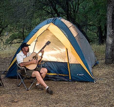 February 26, 2021 Bald Eagles Build New Nest A nesting pair of bald eagles that lost their nest tree in the North Complex Fire have returned. Environmental scientists with the Department of Water Resources have located a newly built nest in an undamaged tree within their territory and observed nesting activity on the new nest by the pair. Lake Oroville and the Feather River area provide ideal habitat for bald eagles. Fish are one of the eagles’ main food sources and large water bodies like Lake Oroville provide a wide variety of fish as well as other favorite food sources such as waterfowl, small birds, and mammals. The many trees and snags (tall dead trees) near water areas provide prime nesting, roosting, and hunting locations. Protecting the area’s year-round bald eagle population living in the Department of Water Resources’ (DWR) Oroville-Thermalito Complex jurisdiction is the responsibility of the Oroville Field Division’s Environmental Scientists. The bald eagle is a protected species under the Migratory Bird Treaty Act of 1918 and Bald and Golden Eagle Protection Act of 1940. They were listed as an endangered species in 1978. Those protections have been successful, and the species is now federally delisted. DWR’s scientists monitor for and, if necessary, act against threats such as public intrusions, habitat loss, or other impacts to the eagles’ nesting areas. Photo: Bald eagle nest in unburned tree near North Complex Wildfire burn scar - inside red circle Monument Hill Facility Closure The Monument Hill Boat Ramp and Day Use Area’s boat ramp and beach on the Thermalito Afterbay, off Highway 162 near State Route 99, will be closed March 3 and March 4 for maintenance. DWR will be improving the facilities by replacing eroded sand on the beach and addressing issues with the boarding float at the boat launch. The nearby Wilbur Road Boat Ramp facility will be available for boat launching into the Thermalito Afterbay. Additionally, the Car-top Boat Ramp on Larkin Road remains open. The public is reminded of the 5-miles per hour boating speed limit on the portion of the Thermalito Afterbay north of the Highway 162 bridge. The Thermalito Afterbay, part of DWR’s Oroville-Thermalito Complex, is a large water supply reservoir in the Oroville Wildlife Area (OWA). The OWA is administered for DWR by California Department of Fish and Wildlife (CDFW). 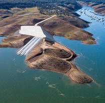 Oroville Recreation The Lake Oroville State Recreation Area (LOSRA) campgrounds at Bidwell Canyon, Loafer Creek – including the Equestrian Campground, and the Lime Saddle Campground are open. Group camping, including floating campgrounds, and boat-in campgrounds remain closed. Reservation capability does not open until April and camping sites will be allocated on a ‘first come-first serve’ basis. The Potters Ravine and North Fork trails are open for use. CA Parks encourages users to remain on the trails. Assessments by CA Parks staff of trail safety are ongoing. All day use facilities at Lake Oroville State Recreation Area (LOSRA) are open. The Lake Oroville Visitor Center remains closed. Visit the California Parks LOSRA webpage for current information on facility status as well as current requirements to protect public health during the COVID-19 pandemic. Information about recreation facilities can be found in DWR’s interactive map on the Lake Oroville Recreation webpage. For information about the Oroville Wildlife Area, including the Thermalito Afterbay, visit the California Department of Fish and Wildlife webpage. Photo: Camping at the Lake Oroville State Recreation Area 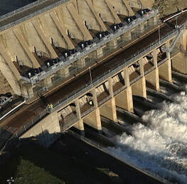 Lake Oroville Boat Ramps The Lime Saddle Boat Ramp is now open for use along with Bidwell Canyon and Spillway boat ramps. Bidwell Canyon and Lime Saddle boat ramps are open 24-hours per day and the Spillway boat ramps are open from 6 a.m. to 8 p.m. daily. The Lake Oroville Marina at Lime Saddle is open 8 a.m. to 4:30 p.m. and the Bidwell Canyon Marina is open 7 a.m. to 8 p.m. The Loafer Creek boat ramps remain out of the water. The Loafer Point Stage II boat ramp project to construct six boat launch lanes and 180 trailered parking spaces to allow boaters to enter the lake when lake levels are below 805 feet elevation is nearing completion. This year’s low lake levels provided DWR the opportunity to build the ramp down to elevation 703 feet. When the lake levels are lower due to dry years in the future, the ramp will be extended to lower lake elevations. The Loafer Point Stage I boat ramp was completed in 2020 and added three new boat launch lanes from a full lake down to 799 feet, a new parking area, and new restroom facilities. Both facilities are adjacent to the Loafer Creek Recreation Day Use Area and Campground, rounding out a full-service recreation destination with nearby trails, campgrounds, boating, and marina. Photo: Loafer Point Stage II boat ramp and parking lot with Bidwell Canyon's new boat ramp in background 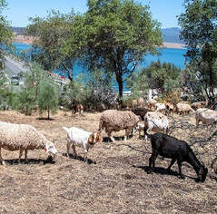 Wildfire Impacts on Water Quality The multi-agency “Watershed Working Group”, led by the California Governor’s Office of Emergency Services (CalOES), continues targeted monitoring of rivers, lakes, and other surface waters in the North Complex burn area and downstream. The Central Valley Regional Water Quality Control Board (Water Board), the California Department of Fish and Wildlife (CDFW), and the Department of Water Resources (DWR) collect and test water samples for analysis. The Water Board’s recent news release states elevated results found are not impacting drinking water treatment facilities nor the quality of drinking water. Water testing will continue and the Watershed Working Group will report results in the weeks ahead. The Water Board will alert the public if results show water quality may be impacted. Photo: DWR water quality experts collect water samples on Lake Oroville Current Lake Operations The elevation of Oroville’s reservoir is about 710 feet elevation and storage is about 1.33 million acre-feet, 55 percent of historical average. Currently, in the Northern Sierra Basin, rainfall is below average, at 51 percent of normal for this time of year and snowpack is also below average at 66 percent of normal. Expect continued dry conditions this week and into the week of March 1. The total releases to the Feather River will be reduced from 1,250 cfs to 1,050 cfs on Monday, March 1 to conserve storage in Lake Oroville. Come March 1, the Feather River flows will consist of 800 cfs down the Low Flow Channel through the City of Oroville, and 250 cfs from the Thermalito Afterbay Outlet (Outlet) for a total of 1,050 cfs for the Feather River’s high flow channel downstream of the Outlet. The public can track precipitation, snow, reservoir levels, and more at the California Data Exchange Center at www.cdec.water.ca.gov. Lake Oroville is identified as “ORO”. All data as of midnight 2/25/2021 ### Know someone who would like to receive Community Updates? They can email their request to [email protected]. |
Archives
October 2023
Categories
All
|

 RSS Feed