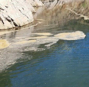
 May 13, 2022 Drought Update California has experienced the driest January through March on record, leaving the statewide snowpack at 23 percent of average for this date despite the recent late season storms. The main benefit of late season storms will be to prevent soils from drying out early in the season, which can aid runoff efficiency of the remaining snowpack to the state’s reservoirs. Reservoir levels across California vary depending on their location and source of inflows but all are reflective of the state entering its third year of drought. Locally, record-setting precipitation from the late October 2021 atmospheric river (AR) storm fell mainly in the Feather River (Oroville Dam) and American River (Folsom Dam) watersheds, missing a large part of the Lake Shasta watershed. Lake Oroville currently has more storage than on this date last year and the Department of Water Resources (DWR) is working to preserve as much storage as possible for future needs to maintain Delta water quality, protect endangered species, and meet senior water right obligations. DWR is also administering a number of grant programs to help mitigate and address drought impacts. One program, the Small Community Drought Relief Program, has already awarded more than $33 million to local counties and cities around Oroville for projects such as water system improvements and connections in Orland, Berry Creek, and Williams and for water hauling in Butte, Glenn, and Colusa counties. The DWR hydrology team and a California Water Board data specialist held a media briefing with reporters and meteorologists Tuesday to discuss the latest drought data points and where we stand in terms of current conditions. A recording of the briefing is available on the DWR YouTube webpage. As we enter the warmer months, everyone is encouraged to find ways to save water, because despite current reservoir levels, the state is going to have water challenges later this year. See tips, tools, and ideas on the Save Our Water website. Information about real time local hydrological conditions, forecasts, and water conditions is available on DWR’s new website California Water Watch. Visit DWR’s Drought webpage for the latest information. 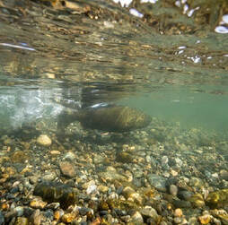 COLLABORATING TO SUPPORT SALMON Managing California's water needs during our severe drought means minimizing impacts on our environment while also meeting the health and safety, economic, and agriculture needs of our communities. The Department of Water Resources (DWR) and Department of Fish and Wildlife (CDFW) are actively working to respond to drought and climate change impacts posing challenges to our native species and ecosystems, including California’s salmon populations. Scientists and fish biologists from both DWR and CDFW have a long history of working together and collaborating with federal, state, local, non-governmental, tribal, and academic partners who have joined forces to protect and support California’s salmon populations. Collaborating through shared projects, funding, and research efforts, DWR and CDFW are identifying critical challenges facing salmon and using the best available science and technology to find ways to promote salmon health and survival. The state has embarked on dozens of projects to ensure the success of California’s salmon population. Some of these projects are highlighted in the recent DWR-CDFW news release. These projects include restoring critical habitat for salmon and other fish species, improving salmon migration corridors to and from the ocean, and increasing our monitoring efforts so we can better track the status of populations and devise new strategies to improve their status. View the latest video on the DWR YouTube channel. To learn more about collaborative projects protecting our salmon populations, check out the DWR website highlighting these efforts and more. Additional projects will be featured throughout the summer. 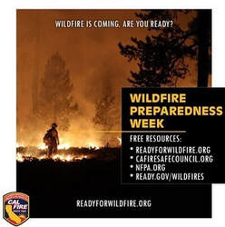 WILDFIRE PREPAREDNESS WEEK RECAP California Governor Gavin Newsom recently proclaimed May 1 to May 7, 2022, as “Wildfire Preparedness Week”. With California experiencing some of the largest and most destructive fires over the last few years and lingering drought conditions leaving fuel moisture levels very low, the state is taking action to help make communities more resilient to wildfire and improve forest health. “I urge all Californians to take lifesaving steps to stay prepared, including making their homes more fire-resistant, creating defensible space, and developing a wildfire action plan well ahead of time” Governor Newsom said. CAL FIRE kicked off the week with educational events across the state to raise awareness on wildfire preparedness, including how state, federal, and local public safety organizations are preparing for the 2022 fire season. CAL FIRE stresses the importance of fuel reduction and vegetation management projects and ways the public can prepare for wildfire through making your home more fire resistant (home hardening), creating defensible space, and developing a wildfire action plan well ahead of time. DWR continues to prepare for wildfire around the Oroville-Thermalito Complex by implementing fuel reduction projects and creating defensible space around infrastructure and adjacent to residential communities. Through the use of grazing, brush removal, chipping, and controlled burns DWR with area partners including CAL FIRE, California Department of Parks and Recreation (CA Parks), Butte County Fire Safe Council (BCFSC) aim to reduce wildfire risk, increase public safety, and promote forest health. Currently, DWR in partnership with BCFSC and goats from Hanski Family Farms are grazing 35 acres along Oro Dam Blvd. East with the goal of reducing ladder fuels to help lessen the spread of a potential wildfire, protecting infrastructure and nearby communities. Californians are encouraged to join these wildfire preparedness efforts by taking actions now to protect your home and family. Develop your personalized plan by visiting https://plan.readyforwildfire.org/.  OROVILLE RECREATION The Spillway Boat Ramp opened on April 29, joining the open Loafer Point, Bidwell Canyon, and Lime Saddle boat ramps. The Foreman Creek and Stringtown cartop boat ramps are also open. Restrooms, potable water, and fish cleaning stations are not in service at the Spillway Boat Ramp area but portable toilets are provided – please plan visits accordingly. Information on current boat ramp status can be found on the California State Parks’ Lake Oroville State Recreation Area webpage. Scroll down to the link for “Current Launch Ramp Status”. Visitors to Oroville Dam and the Spillway Boat Ramp area will be able to use the newly constructed Lakeside Access Road which descends into the lake inundation zone before travelling back up to the Spillway Boat Ramp parking lot where they can access boat launch lanes, a shaded day use area with picnic tables, and multi-use trails suitable for hikers, bikers, and equestrians. The previous access road through the CHP screening booths and below the Emergency Spillway will only need to be used when lake elevations rise high enough to flood the new Lakeside Access Road. The Lake Oroville Visitor Center is open to the public on Tuesdays, Wednesdays, and Thursdays from 9 a.m. to 5 p.m. Pick up the Lake Oroville Trails Map, which shows more than 91 miles of trails available to equestrians, bicyclists, and hikers, at Lake Oroville State Recreation Area (LOSRA) kiosks, the Oroville Area Chamber of Commerce, and Feather River Recreation and Parks District. The Loafer Creek Recreation Area continues to be closed due to waterline repair (boat ramp and trail access allowed). Visit the California Parks LOSRA webpage for current information on facility status and campground reservations. An interactive map of recreation facilities in DWR’s Oroville-Thermalito Complex is available on DWR’s Lake Oroville Recreation webpage. Information about the 11,000-acre Oroville Wildlife Area is available on the California Department of Fish and Wildlife webpage. CURRENT LAKE OPERATIONS The elevation of Oroville’s reservoir is about 776 feet elevation and storage is about 1.93 million acre-feet, which is 55 percent of its total capacity and 70 percent of historical average. Lake Oroville likely hit its peak storage for this Water Year on May 8 at 1.94 million acre-feet (MAF), about 400 thousand acre-feet higher than the peak in 2021. Dry and warmer temperatures in the mid-to-upper-80s are forecast over the weekend and into next week. Average daily inflows this week have been in the range of 3,000 to 4,000 cubic feet per second (cfs) and are expected to be in this range or slightly lower over the coming week. The Feather River releases are at 2,200 cfs to meet downstream Delta water quality and outflow needs. Flow in the low-flow channel through the City of Oroville is 650 cfs and flow through the Thermalito Afterbay Outlet is currently 1,550 cfs. Flows are assessed daily. The public can track precipitation, snow, reservoir levels, and more at the California Data Exchange Center at www.cdec.water.ca.gov. The Lake Oroville gage station is identified as “ORO”. All data as of midnight 5/12/2022  California is entering its third year of drought conditions. With water conservation now a way of life in California, everyone is encouraged to find ways to save water. See tips, tools, and ideas on the Save Our Water website. Information about real time local hydrological conditions, forecasts, and water conditions is available on DWR’s new website California Water Watch.
 May 6, 2022 Collaborating to Support Salmon Managing California's water needs during our severe drought means minimizing impacts on our environment while also meeting the health and safety, economic, and agriculture needs of our communities. The Department of Water Resources (DWR) and Department of Fish and Wildlife (CDFW) are actively working to respond to drought and climate change impacts posing challenges to our native species and ecosystems, including California’s salmon populations. Scientists and fish biologists from both DWR and CDFW have a long history of working together and collaborating with federal, state, local, non-governmental, tribal, and academic partners who have joined forces to protect and support California’s salmon populations. Collaborating through shared projects, funding, and research efforts, DWR and CDFW are identifying critical challenges facing salmon and using the best available science and technology to find ways to promote salmon health and survival. The state has embarked on dozens of projects to ensure the success of California’s salmon population. Some of these projects are highlighted in the recent DWR-CDFW news release. These projects include restoring critical habitat for salmon and other fish species, improving salmon migration corridors to and from the ocean, and increasing our monitoring efforts so we can better track the status of populations and devise new strategies to improve their status. View the latest video on the DWR YouTube channel. To learn more about collaborative projects protecting our salmon populations, check out the DWR website highlighting these efforts and more. Additional projects will be featured throughout the summer.  WILDFIRE PREPAREDNESS WEEK California Governor Gavin Newsom has proclaimed May 1 to May 7, 2022, as “Wildfire Preparedness Week”. With California experiencing some of the largest and most destructive fires over the last few years and lingering drought conditions leaving fuel moisture levels very low, the state is taking action to help make communities more resilient to wildfire and improve forest health. “I urge all Californians to take lifesaving steps to stay prepared, including making their homes more fire-resistant, creating defensible space, and developing a wildfire action plan well ahead of time” Governor Newsom said. CAL FIRE kicked off the week with educational events across the state to raise awareness on wildfire preparedness, including how state, federal, and local public safety organizations are preparing for the 2022 fire season. CAL FIRE stresses the importance of fuel reduction and vegetation management projects and ways the public can prepare for wildfire through making your home more fire resistant (home hardening), creating defensible space, and developing a wildfire action plan well ahead of time. DWR continues to prepare for wildfire around the Oroville-Thermalito Complex by implementing fuel reduction projects and creating defensible space around infrastructure and adjacent to residential communities. Through the use of grazing, brush removal, chipping, and controlled burns DWR with area partners including CAL FIRE, California Department of Parks and Recreation (CA Parks), Butte County Fire Safe Council (BCFSC) aim to reduce wildfire risk, increase public safety, and promote forest health. Currently, DWR in partnership with BCFSC and goats from Hanski Family Farms are grazing 35 acres along Oro Dam Blvd. East with the goal of reducing ladder fuels to help lessen the spread of a potential wildfire, protecting infrastructure and nearby communities. Californians are encouraged to join these wildfire preparedness efforts by taking actions now to protect your home and family. Develop your personalized plan by visiting https://plan.readyforwildfire.org/. OROVILLE RECREATION ADVISORY COMMITTEE The Oroville Recreation Advisory Committee met today, May 6 at the Southside Community Center in Oroville. ORAC was established by the Federal Energy Regulatory Commission (FERC) to review and provide recommendations regarding DWR’s recreation plan for the Project No. 2100 – Oroville Facilities. The 13-member committee is made up of representatives from state and local government, sports and recreation groups, and business and community organizations. To obtain a summary of the meeting, send a request to oroville@water.ca.gov. 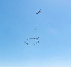 MAPPING STATE’S GROUNDWATER BASINS DWR is conducting an innovative, helicopter-based technology of airborne electromagnetic (AEM) surveys to gather information about the state’s groundwater aquifer structure to support drought response and the implementation of the Sustainable Groundwater Management Act (SGMA). The AEM surveys are scheduled in groundwater basins within portions of Colusa, Butte, Glenn, Tehama, and Shasta counties during May. Survey data creates an image of the subsurface down to a depth of about 1,000 feet below ground surface and provides information about large-scale aquifer structures and geology. This information supports the implementation of local groundwater sustainability plans (GSPs), which can help local agencies sustainably manage groundwater during drought. DWR has a short 2-minute video about the AEM method, provided in both English and Spanish, as well as an AEM project website. DWR encourages residents to get involved in their local groundwater management activities and GSP implementation through your groundwater sustainability agency (GSA). Information about local GSAs can be found on the SGMA portal. 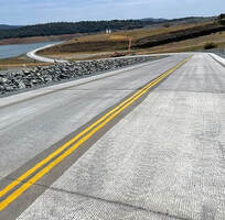 LAKESIDE ACCESS ROAD OPENS Visitors to the Spillway Boat Ramp and Day Use Area and nearby trails are now using the newly constructed Lakeside Access Road. The new, more direct road, which can be used when lake elevations are below 800 feet, begins from the Oroville Dam Crest Parking lot at the northwest of Oroville Dam. The new road descends into the lake inundation zone before travelling back up to the Spillway Boat Ramp parking lot. The previous access road through the CHP screening booths and below the Emergency Spillway will only need to be used when lake elevations rise high enough to flood the new Lakeside Access Road. Visitors are cautioned to be alert for continuing construction activities and to follow signage. 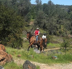 OROVILLE RECREATION The Spillway Boat Ramp opened on April 29, joining the open Loafer Point, Bidwell Canyon, and Lime Saddle boat ramps. The Foreman Creek and Stringtown cartop boat ramps are also open. Restrooms, potable water, and fish cleaning stations are not in service at the Spillway Boat Ramp area but portable toilets are provided – please plan visits accordingly. Information on current boat ramp status can be found on the California State Parks’ Lake Oroville State Recreation Area webpage. Scroll down to the link for “Current Launch Ramp Status”. The Lake Oroville Visitor Center is open to the public on Tuesdays, Wednesdays, and Thursdays from 9 a.m. to 5 p.m. Pick up the Lake Oroville Trails Map, which shows more than 91 miles of trails available to equestrians, bicyclists, and hikers, at Lake Oroville State Recreation Area (LOSRA) kiosks, the Oroville Area Chamber of Commerce, and Feather River Recreation and Parks District. The Loafer Creek Recreation Area continues to be closed due to waterline repair (boat ramp and trail access allowed). Visit the California Parks LOSRA webpage for current information on facility status and campground reservations. An interactive map of recreation facilities in DWR’s Oroville-Thermalito Complex is available on DWR’s Lake Oroville Recreation webpage. Information about the 11,000-acre Oroville Wildlife Area is available on the California Department of Fish and Wildlife webpage. CURRENT LAKE OPERATIONS The elevation of Oroville’s reservoir is about 776 feet elevation and storage is about 1.95 million acre-feet, which is 55 percent of its total capacity and 70 percent of historical average. Cooler temperatures in the mid-60s and low-70s are anticipated through the weekend and into next week with a chance of rain later in the weekend and into next week. Average daily inflows this week have been tapering off and have been in the range of 4,000 to 5,500 cubic feet per second (cfs) and will continue to taper off and are projected to be in the range 3,000 to 4,000 cfs. On Friday, May 6, 2022, flows to the Feather River were increased to 1,200 cfs to meet downstream Delta water quality and outflow needs. Flow in the low-flow channel through the City of Oroville is 650 cfs and flow through the Thermalito Afterbay Outlet is currently 550 cfs. Flows are assessed daily. The public can track precipitation, snow, reservoir levels, and more at the California Data Exchange Center at www.cdec.water.ca.gov. The Lake Oroville gage station is identified as “ORO”. All data as of midnight 5/6/2022  California is entering its third year of drought conditions. With water conservation now a way of life in California, everyone is encouraged to find ways to save water. See tips, tools, and ideas on the Save Our Water website. Information about real time local hydrological conditions, forecasts, and water conditions is available on DWR’s new website California Water Watch.
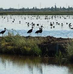 April 22, 2022 DWR Partners with California Rice Commission The Department of Water Resources (DWR) has provided $8 million dollars to the California Rice Commission’s ‘California Ricelands Waterbird Foundation’ to help increase the amount of available flooded habitat for migratory birds making their journey along the Pacific Flyway this year. Current drought conditions have reduced summer flooding of semi-permanent wetlands in the Sacramento Valley, reducing essential resources for breeding waterfowl, shorebirds, and other wetland-dependent species that are severely impacted by the drought. This past winter and through the spring, DWR supported a collaboration of multiple partners, including Audubon California, Ducks Unlimited, The Nature Conservancy, California Department of Fish and Wildlife (CDFW) and others, to create nearly 55,000 acres of flooded waterbird habitat on rice fields and private wetlands by providing incentive payments to wetland owners to flood (or hold water from winter flooding) their wetlands to a depth of 12 to 24 inches beginning April 1, 2022 until July 15, 2022. After July 15, wetland managers will rely on evaporation (vs. draining) to draw down flooded fields, extending vital habitat for migrating shorebirds who prefer shallow waters. As the DWR manages California’s water needs during this water supply crisis, actions and projects like this one to minimize the impacts of drought and water management on our environment (while still meeting the needs of our communities’ health and safety, our economy, and agriculture), will significantly benefit wildfowl migrating up and down the Western United States as well as those who live in the Valley year-round. Flood Safety Stakeholder Technical Workshop The Oroville Dam Citizens Advisory Commission held a virtual Flood Safety Stakeholder Technical Workshop on April 22 to allow the California Natural Resources Agency (CNRA), DWR, and other government officials hear directly from and speak directly to community stakeholders about their goals, interests and concerns related to flood safety and downstream communities. Presentations on extreme precipitation, managing floods, forecasting, and how dams, channels, floodplains, burn scars, and adequate preparations impact flooding and response were provided. Stakeholders and public participants asked questions and offered comments. The meeting transcript and presentations will be available on the Commission’s website in the coming weeks https://bit.ly/OrovilleCAC. 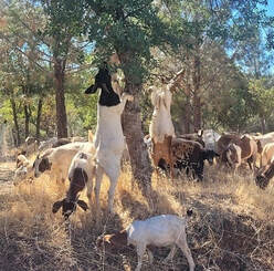 GRAZING GOATS REDUCE FIRE RISK Hillsides along the Dan Beebe trail near Hyatt Powerplant and Oroville Dam’s Lower Overlook are looking different as 600 goats and sheep from the Hanski Family Farms are visiting the area. The goal for this grazing effort is to minimize the rate of spread of a potential fire by reducing ground fuels, ladder fuels, and overgrown vegetation on approximately 35 acres near Oro Dam Boulevard East. Grazing is gaining popularity across California as a sustainable method to minimize wildfire risk and lessen the spread of a wildfire through vegetation management. The goats and sheep near Hyatt Powerplant will graze on grasses, leaves, poison oak, and a variety of shrubs and trees. By standing on their hind legs, they can reduce ladder fuels up to six feet high. Plus, they love to eat weeds, especially invasive ones. The goat grazing project is part of DWR’s Fuel Load Management Plan, which helps reduce wildfire risk, increase public safety, and enhance forest health in areas around Lake Oroville within the Federal Energy Regulatory Commission (FERC) project boundary. In partnership with Butte County Fire Safe Council, DWR continues to use grazing as a sustainable method of fuel reduction around DWR’s Oroville-Thermalito Complex. To learn more and to see goat grazing in action, visit DWRs YouTube Channel for a video of the March 2021 Lakeland Boulevard goat grazing project on DWR’s YouTube webpage.  OROVILLE RECREATION The Loafer Point, Bidwell Canyon, and Lime Saddle boat ramps are open. The Oroville Dam Spillway boat ramp remains closed for repairs. The Foreman Creek and Stringtown cartop boat ramps are also open. Information on current boat ramp status can be found on the California State Parks’ Lake Oroville State Recreation Area webpage. Scroll down to the link for “Current Launch Ramp Status”. The Lake Oroville Visitor Center is open to the public on Tuesdays, Wednesdays, and Thursdays from 9 a.m. to 5 p.m. Pick up the Lake Oroville Trails Map, which shows more than 91 miles of trails available to equestrians, bicyclists, and hikers, at Lake Oroville State Recreation Area (LOSRA) kiosks, the Oroville Area Chamber of Commerce, and Feather River Recreation and Parks District. The Loafer Creek Recreation Area continues to be closed due to waterline repair (boat ramp and trail access allowed). Visit the California Parks LOSRA webpage for current information on facility status and campground reservations. An interactive map of recreation facilities in DWR’s Oroville-Thermalito Complex is available on DWR’s Lake Oroville Recreation webpage. Information about the 11,000-acre Oroville Wildlife Area is available on the California Department of Fish and Wildlife webpage. CURRENT LAKE OPERATIONS The elevation of Oroville’s reservoir is about 764 feet elevation and storage is about 1.81 million acre-feet, which is 51 percent of its total capacity and 68 percent of historical average. Dry and warmer conditions are forecasted this weekend and into the week with temperatures in the mid-70s to low-80s. Because of the recent rain, average daily inflows this week have been between 6,000 to 10,000 cubic feet per second (cfs) and are projected to remain in this range through the weekend and into next week. Flows to the Feather River are 800 cfs. Flow in the low-flow channel through the City of Oroville is 650 cfs and flow through the Thermalito Afterbay Outlet currently is 150 cfs. Flows are assessed daily. The public can track precipitation, snow, reservoir levels, and more at the California Data Exchange Center at www.cdec.water.ca.gov. The Lake Oroville gage station is identified as “ORO”. All data as of midnight 4/21/2022  California is entering its third year of drought conditions. With water conservation now a way of life in California, everyone is encouraged to find ways to save water. See tips, tools, and ideas on the Save Our Water website. Information about real time local hydrological conditions, forecasts, and water conditions is available on DWR’s new website California Water Watch.
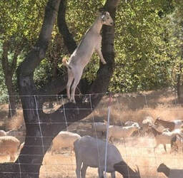 April 15, 2022 Flood Safety Stakeholder Technical Workshop On Friday, April 22, from 9 a.m. to noon, the Oroville Dam Citizens Advisory Commission will be sponsoring a Flood Safety Stakeholder Technical Workshop. The purpose of this virtual workshop is to allow the California Natural Resources Agency (CNRA), California Department of Water Resources (DWR), and other government officials to hear directly from and speak directly to community stakeholders about their goals, interests and concerns related to flood safety and downstream communities. There will be time for community stakeholder questions and comments following each presentation, and there will be additional time for questions and comments from community stakeholders during a public comment period following the presentations. For more information about the virtual workshop please visit: https://bit.ly/OrovilleCAC. Grazing Goats Reduce Fire Risk Hillsides along the Dan Beebe Trail near Hyatt Powerplant and Oroville Dam’s Lower Overlook will look different after 600 goats and sheep from the Hanski Family Farms visit the area. The goal for this grazing effort is to minimize the rate of spread of a potential fire by reducing ground fuels, ladder fuels, and overgrown vegetation on approximately 35 acres near Oro Dam Boulevard East. Grazing is gaining popularity across California as a sustainable method to minimize wildfire risk and lessen the spread of a wildfire through vegetation management. The goats and sheep near Hyatt Powerplant will graze on grasses, leaves, poison oak, and a variety of shrubs and trees. By standing on their hind legs, they can reduce ladder fuels up to six feet high. Plus, they love to eat weeds, especially invasive ones. The goat grazing project is part of DWR’s Fuel Load Management Plan, which helps reduce wildfire risk, increase public safety, and enhance forest health in areas around Lake Oroville within the Federal Energy Regulatory Commission (FERC) project boundary. In partnership with Butte County Fire Safe Council, DWR continues to use grazing as a sustainable method of fuel reduction around DWR’s Oroville-Thermalito Complex. To learn more and to see goat grazing in action, visit DWRs YouTube Channel for a video of the March 2021 Lakeland Boulevard goat grazing project on DWR’s YouTube webpage. 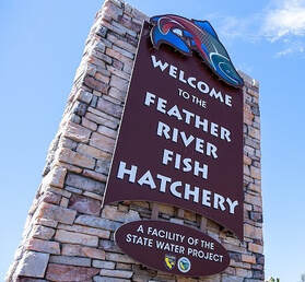 Feather River Fish Hatchery Opens All but one of the California Department of Fish and Wildlife (CDFW) fish hatcheries are open. The hatcheries have been closed for nearly two years during the COVID-19 pandemic. The main Feather River Fish Hatchery facility in Oroville is now open from 7:30 a.m. to 4 p.m. seven days a week. The viewing window and overlook side will continue to be open sunrise to sunset. Learn how the hatchery raises Chinook salmon and steelhead to support California’s salmon populations during your visit. Interpretive panels describing the salmon life cycle, hatchery operations, and more are available for visitors. A virtual tour of the hatchery is also available on the Department of Water Resources (DWR) YouTube channel. Guided tours of the hatchery will resume when the fall-run Chinook salmon return to the river later this year. The Feather River Fish Hatchery (FRFH) is divided into 2 sections:
The Feather River Fish Hatchery is a California State Water Project facility owned and maintained by DWR, which funds hatchery operations. CDFW operates the hatchery, including fish spawning, rearing, and stocking activities. DWR built the fish hatchery to mitigate the impact of the Oroville Dam on Chinook salmon and steelhead populations because the dam blocks access to natural spawning grounds further upstream.  Oroville Recreation The Loafer Point, Bidwell Canyon, and Lime Saddle boat ramps are open. The Oroville Dam Spillway boat ramp remains closed for repairs. The Foreman Creek and Stringtown cartop boat ramps are also open. Information on current boat ramp status can be found on the California State Parks’ Lake Oroville State Recreation Area webpage. Scroll down to the link for “Current Launch Ramp Status”. The Lake Oroville Visitor Center is open to the public on Tuesdays, Wednesdays, and Thursdays from 9 a.m. to 5 p.m. Pick up the Lake Oroville Trails Map, which shows more than 91 miles of trails available to equestrians, bicyclists, and hikers, at Lake Oroville State Recreation Area (LOSRA) kiosks, the Oroville Area Chamber of Commerce, and Feather River Recreation and Parks District. The Loafer Creek Recreation Area continues to be closed due to waterline repair (boat ramp and trail access allowed). Visit the California Parks LOSRA webpage for current information on facility status and campground reservations. An interactive map of recreation facilities in DWR’s Oroville-Thermalito Complex is available on DWR’s Lake Oroville Recreation webpage. Information about the 11,000-acre Oroville Wildlife Area is available on the California Department of Fish and Wildlife webpage. Current Lake Operations The elevation of Oroville’s reservoir is about 754 feet elevation and storage is about 1.71 million acre-feet, which is 48 percent of its total capacity and 66 percent of historical average. Temperatures in the mid-to-upper-60s and rain is forecasted on Saturday with cooler temperatures and chance of rain continuing into next week. The average daily inflows this week have been between 3,000 to 5,000 cubic feet per second (cfs). Inflows into Lake Oroville this weekend may be in the range of 5,000 to 7,000 cfs due to the forecasted rain in the Feather River Basin. Throughout April, total flows to the Feather Rivers have been reduced to conserve storage. As of Friday, April 15, total flows to the Feather River are at 800 cfs. At 800 cfs to the Feather River, flow in the low-flow channel through the City of Oroville is 650 cfs and flow through the Thermalito Afterbay Outlet currently is 150 cfs. Flows are assessed daily. The public can track precipitation, snow, reservoir levels, and more at the California Data Exchange Center at www.cdec.water.ca.gov. The Lake Oroville gage station is identified as “ORO”. All data as of midnight 4/14/2022  California is entering its third year of drought conditions. With water conservation now a way of life in California, everyone is encouraged to find ways to save water. See tips, tools, and ideas on the Save Our Water website. Information about real time local hydrological conditions, forecasts, and water conditions is available on DWR’s new website California Water Watch.
 April 8, 2022 Feather River Fish Hatchery Opens The California Department of Fish and Wildlife (CDFW) announced starting April 7, they will be re-opening 21 of the 22 state fish hatcheries. The hatcheries have been closed for nearly two years during the COVID-19 pandemic. The main Feather River Fish Hatchery facility in Oroville is now open from 7:30 a.m. to 4 p.m. seven days a week. The viewing window and overlook side will continue to be open sunrise to sunset. The Feather River Fish Hatchery (FRFH) is divided into 2 sections:
Over 8 million spring-run and fall-run Chinook salmon are produced by the hatchery annually, along with nearly 450,000 steelhead who are returned to the Feather River or planted in the Thermalito Afterbay for recreational users. To mitigate impacts from this third year of drought conditions, the facility will be raising an additional 1.7 million fall-run Chinook salmon to support the Feather River population. An additional 125,000 Inland Chinook will be planted in Lake Oroville this spring. The Feather River Fish Hatchery is a California State Water Project facility owned and maintained by DWR, which funds hatchery operations. CDFW operates the hatchery, including fish spawning, rearing, and stocking activities. DWR built the fish hatchery to mitigate the impact of the Oroville Dam on Chinook salmon and steelhead populations because the dam blocks access to natural spawning grounds further upstream.  SNOWPACK SURVEY The Department of Water Resources (DWR) conducted the fourth snow survey of the season April 1 at Phillips Station near Echo Summit. Following a January, February, and March that will enter records as the driest documented in state history, the manual survey recorded 2.5 inches of snow depth and a snow water equivalent of 1 inch, which is 4 percent of average for this location for April. The snow water equivalent measures the amount of water contained in the snowpack and is a key component of DWR’s water supply forecast. Statewide, the snowpack was 38 percent of average for the April 1 date. (One week later, due to high temperatures causing more snowmelt, the statewide average was at 27 percent.) “The conditions we are seeing today speak to how severe our drought remains. DWR has been planning for the reality of a third dry year since the start of the water year on October 1,” said DWR Director Karla Nemeth. “While DWR has made significant investments in forecasting technology and other tools to ensure we make the most out of the snowmelt we do receive, water conservation will remain our best tool in the face of this ongoing drought and the statewide impacts of a warming climate. All Californians must focus on conserving water now.” The full snow survey news release can be found on the DWR News page. Governor Gavin Newsom has asked all Californians to cut back water use at least 15 percent compared to 2020 levels. Current water conditions are now available in real time at California Water Watch, a new website launched by DWR. The website will help Californians see their local hydrological conditions, forecasts, and water conditions down to their address or their local watershed. Additional tips on how to conserve can be found at the SaveOurWater webpage.  OROVILLE RECREATION The Loafer Point, Bidwell Canyon, and Lime Saddle boat ramps are open (except on April 4 for Loafer Point). The Oroville Dam Spillway boat ramp remains closed for repairs. The Foreman Creek and Stringtown cartop boat ramps are also open. Information on current boat ramp status can be found on the California State Parks’ Lake Oroville State Recreation Area webpage. Scroll down to the link for “Current Launch Ramp Status”. The Lake Oroville Visitor Center is open to the public on Tuesdays, Wednesdays, and Thursdays from 9 a.m. to 5 p.m. Pick up the Lake Oroville Trails Map, which shows more than 91 miles of trails available to equestrians, bicyclists, and hikers, at Lake Oroville State Recreation Area (LOSRA) kiosks, the Oroville Area Chamber of Commerce, and Feather River Recreation and Parks District. The Loafer Creek Recreation Area continues to be closed due to waterline repair (boat ramp and trail access allowed). Visit the California Parks LOSRA webpage for current information on facility status and campground reservations. An interactive map of recreation facilities in DWR’s Oroville-Thermalito Complex is available on DWR’s Lake Oroville Recreation webpage. Information about the 11,000-acre Oroville Wildlife Area is available on the California Department of Fish and Wildlife webpage. CURRENT LAKE OPERATIONS The elevation of Oroville’s reservoir is about 751 feet elevation and storage is about 1.68 million acre-feet, which is 48 percent of its total capacity and 66 percent of historical average. Temperatures over the weekend are forecasted to be in the mid- to upper-70s and decreasing to the 60s and low 70s into next week with a chance of rain mid-week. The average daily inflows this week have been between 3,000 to 5,000 cubic feet per second (cfs) and projected to continue at this rate next week. Inflows are subject to change based upon on actual weather conditions. Starting April 2, 2022, DWR has initiated daily reductions in total flows to the Feather River and flows are projected to be at 1,100 cfs by Sunday. At 1,100 cfs to the Feather River, flow in the low-flow channel through the City of Oroville is 650 cfs and flow through the Thermalito Afterbay Outlet currently is 450 cfs. Flows are assessed daily. The public can track precipitation, snow, reservoir levels, and more at the California Data Exchange Center at www.cdec.water.ca.gov. The Lake Oroville gage station is identified as “ORO”. All data as of midnight 4/8/2022  California is entering its third year of drought conditions. With water conservation now a way of life in California, everyone is encouraged to find ways to save water. See tips, tools, and ideas on the Save Our Water website. Information about real time local hydrological conditions, forecasts, and water conditions is available on DWR’s new website California Water Watch.
 April 1, 2022 Snowpack Survey The Department of Water Resources (DWR) conducted the fourth snow survey of the season Friday at Phillips Station near Echo Summit. Following a January, February, and March that will enter records as the driest documented in state history, the manual survey recorded 2.5 inches of snow depth and a snow water equivalent of 1 inch, which is 4 percent of average for this location for April. The snow water equivalent measures the amount of water contained in the snowpack and is a key component of DWR’s water supply forecast. Statewide, the snowpack is 38 percent of average for this date. “The conditions we are seeing today speak to how severe our drought remains. DWR has been planning for the reality of a third dry year since the start of the water year on October 1,” said DWR Director Karla Nemeth. “While DWR has made significant investments in forecasting technology and other tools to ensure we make the most out of the snowmelt we do receive, water conservation will remain our best tool in the face of this ongoing drought and the statewide impacts of a warming climate. All Californians must focus on conserving water now.” The full snow survey news release can be found on the DWR News page. Governor Gavin Newsom has asked all Californians to cut back water use at least 15 percent compared to 2020 levels. Current water conditions are now available in real time at California Water Watch, a new website launched by DWR. The website will help Californians see their local hydrological conditions, forecasts, and water conditions down to their address or their local watershed. Additional tips on how to conserve can be found at the SaveOurWater webpage. Boat Ramp Closures A speed boat timed trial event on the Thermalito Afterbay is scheduled for April 1 to April 3. The event requires the southern portion of the Afterbay (south of Highway 162) to be closed to the public April 2 and April 3. Both the Monument Hill boat ramp and Larkin Cartop boat launch will be closed. The Wilbur Road boat ramp and areas north of Hwy 162 will remain open. Returning to the Afterbay after two years away due to the COVID-19 pandemic, the 59th Annual Region 9 Bud David Time Trials event is anticipated to draw 40 to 50 boats. Information about the event can be found on the American Power Boat Association webpage at https://www.apba.org/racing-schedule.html The Loafer Point boat launch area will be closed Monday, April 4 for installation of a gate. Boaters are encouraged to use the Bidwell Canyon boat ramp as an alternate launch site on that day. Oroville Dam Citizens Advisory Commission The California Natural Resources Agency (CNRA) held its tenth Oroville Dam Citizens Advisory Commission meeting on March 25, 2022. The online public meeting included a facilities update from the Department of Water Resources (DWR), a presentation on addressing flood risks, and a discussion about public safety partnerships. Members of the public also offered comments and asked questions. The Citizens Advisory Commission is a forum to provide public feedback from the communities surrounding Oroville Dam. The meeting transcript and presentations will be available on the Commission’s website in the coming weeks at https://bit.ly/OrovilleCAC.  OROVILLE RECREATION The Loafer Point, Bidwell Canyon, and Lime Saddle boat ramps are open (except on April 4 for Loafer Point). The Oroville Dam Spillway boat ramp remains closed for repairs. The Foreman Creek and Stringtown cartop boat ramps are also open. Information on current boat ramp status can be found on the California State Parks’ Lake Oroville State Recreation Area webpage. Scroll down to the link for “Current Launch Ramp Status”. The Lake Oroville Visitor Center is open to the public on Tuesdays, Wednesdays, and Thursdays from 9 a.m. to 5 p.m. Pick up the Lake Oroville Trails Map, which shows more than 91 miles of trails available to equestrians, bicyclists, and hikers, at Lake Oroville State Recreation Area (LOSRA) kiosks, the Oroville Area Chamber of Commerce, and Feather River Recreation and Parks District. The Loafer Creek Recreation Area continues to be closed due to waterline repair (boat ramp and trail access allowed). Visit the California Parks LOSRA webpage for current information on facility status and campground reservations. An interactive map of recreation facilities in DWR’s Oroville-Thermalito Complex is available on DWR’s Lake Oroville Recreation webpage. Information about the 11,000-acre Oroville Wildlife Area is available on the California Department of Fish and Wildlife webpage. CURRENT LAKE OPERATIONS The elevation of Oroville’s reservoir is about 749 feet elevation and storage is about 1.68 million acre-feet, which is 47 percent of its total capacity and 67 percent of historical average. Dry conditions and temperatures in the 80s are forecasted this weekend and next week. The average daily inflows this week have been around 5,000 cubic feet per second (cfs). These higher inflows are attributed to early season snowmelt and projected in the 3,000 to 4,000 cfs range next week. Inflows are subject to change based upon actual weather conditions. Total flows to the Feather River are 3,500 cfs. Flow in the low-flow channel through the City of Oroville is 650 cfs and flow through the Thermalito Afterbay Outlet currently is 2,850 cfs. DWR is planning a reduction of releases to the Feather River in early April. The public can track precipitation, snow, reservoir levels, and more at the California Data Exchange Center at www.cdec.water.ca.gov. The Lake Oroville gage station is identified as “ORO”. All data as of midnight 3/31/2022  California is entering its third year of drought conditions. With water conservation now a way of life in California, everyone is encouraged to find ways to save water. See tips, tools, and ideas on the Save Our Water website. Information about real time local hydrological conditions, forecasts, and water conditions is available on DWR’s new website California Water Watch.
 March 25, 2022 Oroville Dam Citizens Advisory Commission The California Natural Resources Agency (CNRA) held its tenth Oroville Dam Citizens Advisory Commission meeting on March 25, 2022. The online public meeting included a facilities update from the Department of Water Resources (DWR), a presentation on addressing flood risks, and a discussion about public safety partnerships. Members of the public also offered comments and asked questions. The Citizens Advisory Commission is a forum to provide public feedback from the communities surrounding Oroville Dam. The meeting transcript and presentations will be available on the Commission’s website in the coming weeks at https://bit.ly/OrovilleCAC. DWR Announces Revised Water AllocationLast week, DWR announced it must reduce the State Water Project allocation to 5 percent of requested supplies for 2022. DWR previously set the allocation at 15 percent, but a historically dry January and February with no significant storms forecast for March requires a reduction in the allocation to conserve available water supply. In addition to the 5 percent allocation, DWR will also provide any unmet critical health and safety needs of the 29 water agencies that contract to receive State Water Project supplies. “We are experiencing climate change whiplash in real time with extreme swings between wet and dry conditions. That means adjusting quickly based on the data and the science,” said DWR Director Karla Nemeth. “While we had hoped for more rain and snow, DWR has been preparing for a third consecutive year of drought since October. We are continuing with a series of actions to balance the needs of endangered species, water supply conservation, and water deliveries for millions of Californians.” DWR will make its next assessment of the State Water Project allocation following the next snow survey on April 1. A final allocation for the water year is typically announced in May or June. Read the full news release on the DWR News webpage. DWR Begins Monitoring Vernal Pools Some grasslands, including areas around Butte County, have an underlying impervious layer of rock or clay that causes rainwater to pond in the winter and spring, creating seasonal wetlands called vernal pools. Although vernal pools are only a small component of our local grasslands in terms of area, they support a remarkably high diversity of plants and animals, including rare and endangered species and species endemic to California (i.e., found nowhere else in the world). Vernal pool organisms and plants are highly specialized to their unique environment and to the Mediterranean-type climate found in California. They have adapted to living in pools that fill in the winter but are completely dry by the summer, as well as adapting to the sometimes-extreme variability in temperature and rainfall between years. Vernal pools are important targets for conservation because most vernal pools in California have been lost to development, agriculture, and habitat degradation from invasive plants. Vernal pools often support spectacular wildflowers that bloom from March to May. Each spring, Department of Water Resources (DWR) environmental scientists from the Oroville Field Division monitor hundreds of vernal pools around the Oroville area and make assessments on how protection measures for these valuable environmental resources are succeeding. This year scientists are observing wildflowers blooming earlier, likely due to drought conditions, which has reduced the number of “wet” vernal pools found. Scientists also noticed that the areas where CAL FIRE performed controlled burns around the Thermalito Forebay last year to remove invasive grass buildup, or ‘thatch’, and other invasive plants, are abundant with flowers – demonstrating the benefit of such activity on area grasslands and vernal pools. Boat Ramp Closures A speed boat timed trial event on the Thermalito Afterbay is scheduled for April 1 to April 3. The event requires that the southern portion of the Afterbay (south of Highway 162) to be closed to the public April 2 and April 3. Both the Monument Hill boat ramp and Larkin Cartop boat launch will be closed. The Wilbur Road boat ramp and areas north of Hwy 162 will remain open. Returning to the Afterbay after two years away due to the COVID-19 pandemic, the 59th Annual Region 9 Bud David Time Trials event is anticipated to draw 40 to 50 boats. Information about the event can be found on the American Power Boat Association webpage. Loafer Point boat launch area will be closed Monday, April 4 for installation of a gate. Boaters are encouraged to use the Bidwell Canyon boat ramp as an alternate launch site on that day.  OROVILLE RECREATION The Loafer Point, Bidwell Canyon, and Lime Saddle boat ramps are open (except on April 4 for Loafer Point). The Oroville Dam Spillway boat ramp remains closed for repairs. The Foreman Creek and Stringtown cartop boat ramps are also open. Information on current boat ramp status can be found on the California State Parks’ Lake Oroville State Recreation Area webpage. Scroll down to the link for “Current Launch Ramp Status”. The Lake Oroville Visitor Center is open to the public on Tuesdays, Wednesdays, and Thursdays from 9 a.m. to 5 p.m. Pick up the Lake Oroville Trails Map, which shows more than 91 miles of trails available to equestrians, bicyclists, and hikers, at Lake Oroville State Recreation Area (LOSRA) kiosks, the Oroville Area Chamber of Commerce, and Feather River Recreation and Parks District. The Loafer Creek Recreation Area continues to be closed due to waterline repair (boat ramp and trail access allowed). Visit the California Parks LOSRA webpage for current information on facility status and campground reservations. An interactive map of recreation facilities in DWR’s Oroville-Thermalito Complex is available on DWR’s Lake Oroville Recreation webpage. Information about the 11,000-acre Oroville Wildlife Area is available on the California Department of Fish and Wildlife webpage. CURRENT LAKE OPERATIONS The elevation of Oroville’s reservoir is about 746 feet elevation and storage is about 1.64 million acre-feet, which is 47 percent of its total capacity and 67 percent of historical average. Temperatures over the weekend and next week are forecasted to be in the 70s with a chance of rain over the weekend. The average daily inflows this week have been around 3,000 to 5,000 cubic feet per second (cfs) and projected to continue at this rate next week. Inflows are subject to change based upon on actual weather conditions. Total flows to the Feather River are 2,500 cfs. Flow in the low-flow channel through the City of Oroville is 650 cfs and flow through the Thermalito Afterbay Outlet currently is 1,850 cfs. Flows are assessed daily. The public can track precipitation, snow, reservoir levels, and more at the California Data Exchange Center at www.cdec.water.ca.gov. The Lake Oroville gage station is identified as “ORO”. All data as of midnight 3/24/2022  California is entering its third year of drought conditions. With water conservation now a way of life in California, everyone is encouraged to find ways to save water. See tips, tools, and ideas on the Save Our Water website. Information about real time local hydrological conditions, forecasts, and water conditions is available on DWR’s new website California Water Watch.
 March 18, 2022 DWR Begins Monitoring Vernal Pools Some grasslands, including areas around Butte County, have an underlying impervious layer of rock or clay that causes rainwater to pond in the winter and spring, creating seasonal wetlands called vernal pools. Although vernal pools are only a small component of our local grasslands in terms of area, they support a remarkably high diversity of plants and animals, including rare and endangered species and species endemic to California (i.e., found nowhere else in the world). Vernal pool organisms and plants are highly specialized to their unique environment and to the Mediterranean-type climate found in California. They have adapted to living in pools that fill in the winter but are completely dry by the summer, as well as adapting to the sometimes-extreme variability in temperature and rainfall between years. Vernal pools are important targets for conservation because most vernal pools in California have been lost to development, agriculture, and habitat degradation from invasive plants. Vernal pools often support spectacular wildflowers that bloom from March to May. Each spring, Department of Water Resources (DWR) environmental scientists from the Oroville Field Division monitor hundreds of vernal pools around the Oroville area and make assessments on how protection measures for these valuable environmental resources are succeeding. This year scientists are observing wildflowers blooming earlier, likely due to drought conditions, which has reduced the number of “wet” vernal pools found. Scientists also noticed that the areas where CAL FIRE performed controlled burns around the Thermalito Forebay last year to remove invasive grass buildup, or ‘thatch’, and other invasive plants, are abundant with flowers – demonstrating the benefit of such activity on area grasslands and vernal pools. Oroville Dam Citizens Advisory Commission The California Natural Resources Agency is hosting its tenth Oroville Dam Citizens Advisory Commission meeting on Friday, March 25, 2022, from 10 a.m. to 12 p.m. The public meeting will be held online and will include presentations and public comment. The Commission will receive brief facilities updates from the Department of Water Resources (DWR), receive a flood risk presentation, discuss public safety partnerships, and listen to public input. The Citizens Advisory Commission is a forum to provide public feedback from the communities surrounding Oroville Dam. For information on how to join the virtual meeting, visit https://bit.ly/OrovilleCAC. 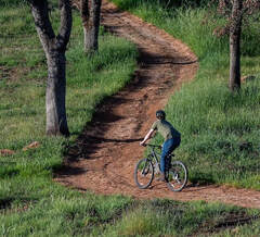 OROVILLE RECREATION The Loafer Point, Bidwell Canyon, and Lime Saddle boat ramps are open. The Oroville Dam Spillway boat ramp remains closed for repairs. The Foreman Creek and Stringtown cartop boat ramps are also open. Intermittent, short duration closures of the Oroville Dam Crest parking lot may occur to accommodate Lakeside Access Road construction activities. The popular walking/bicycling trail across the top of the dam will remain open and parking will continue to be available at the Upper Overlook. Information on current boat ramp status can be found on the California State Parks’ Lake Oroville State Recreation Area webpage. Scroll down to the link for “Current Launch Ramp Status”. The Lake Oroville Visitor Center is open to the public on Tuesdays, Wednesdays, and Thursdays from 9 a.m. to 5 p.m. Pick up the Lake Oroville Trails Map, which shows more than 91 miles of trails available to equestrians, bicyclists, and hikers, at Lake Oroville State Recreation Area (LOSRA) kiosks, the Oroville Area Chamber of Commerce, and Feather River Recreation and Parks District. The Loafer Creek Recreation Area continues to be closed due to waterline repair (boat ramp and trail access allowed). Visit the California Parks LOSRA webpage for current information on facility status and campground reservations. An interactive map of recreation facilities in DWR’s Oroville-Thermalito Complex is available on DWR’s Lake Oroville Recreation webpage. Information about the 11,000-acre Oroville Wildlife Area is available on the California Department of Fish and Wildlife webpage. CURRENT LAKE OPERATIONS The elevation of Oroville’s reservoir is about 743 feet elevation and storage is about 1.61 million acre-feet, which is 46 percent of its total capacity and 68 percent of historical average. Temperatures over the weekend are forecasted to be cooler in the low-60s and about a 0.5 inch of rain in the Feather River Basin is expected. Dry and warmer temperatures in the mid- to-upper-80s are projected to occur next week. The average daily inflows this week have been around 3,000 to 4,000 cubic feet per second (cfs) and are projected to continue at this rate next week. Inflows are subject to change based upon on actual weather conditions. Total flows to the Feather River are 2,500 cfs. Flow in the low-flow channel through the City of Oroville is 650 cfs and flow through the Thermalito Afterbay Outlet currently is 1,850 cfs. Flows are assessed daily. The public can track precipitation, snow, reservoir levels, and more at the California Data Exchange Center at www.cdec.water.ca.gov. The Lake Oroville gage station is identified as “ORO”. All data as of midnight 3/17/2022 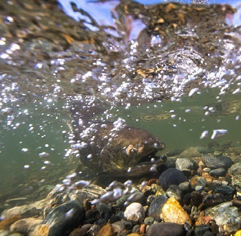 California is entering its third year of drought conditions. With water conservation now a way of life in California, everyone is encouraged to find ways to save water. See tips, tools, and ideas on the Save Our Water website. Information about real time local hydrological conditions, forecasts, and water conditions is available on DWR’s new website California Water Watch.
 March 11, 2022 Oroville Dam Citizens Advisory Commission The California Natural Resources Agency is hosting its tenth Oroville Dam Citizens Advisory Commission meeting on Friday, March 25, 2022, from 10 a.m. to 12 p.m. The public meeting will be held online and will include presentations and public comment. The Commission will receive brief facilities updates from the Department of Water Resources (DWR), receive a flood risk presentation, discuss public safety partnerships, and listen to public input. The Citizens Advisory Commission is a forum to provide public feedback from the communities surrounding Oroville Dam. For information on how to join the virtual meeting, please visit https://bit.ly/OrovilleCAC. Snowpack Survey The Department of Water Resources (DWR) conducted the third snow survey of the season March 1 at Phillips Station near Echo Summit. Following a January and February that will enter records as the driest documented in state history, the manual survey recorded 35 inches of snow depth and a snow water equivalent of 16 inches, which is 68 percent of average for this location for March. The snow water equivalent measures the amount of water contained in the snowpack and is a key component of DWR’s water supply forecast. Statewide, the snowpack is 63 percent of average for this date. “With only one month left in California’s wet season and no major storms in the forecast, Californians should plan for a third year of drought conditions,” said DWR Director Karla Nemeth. The full snow survey news release can be found on the DWR News page. Governor Gavin Newsom has asked all Californians to cut back water use at least 15 percent compared to 2020 levels. Current water conditions are now available in real time at California Water Watch, a new website launched by DWR. The website will help Californians see their local hydrological conditions, forecasts, and water conditions down to their address or their local watershed. Additional tips on how to conserve can be found at the SaveOurWater webpage.  OROVILLE RECREATION
The Loafer Point, Bidwell Canyon, and Lime Saddle boat ramps are open. The Oroville Dam Spillway boat ramp remains closed for repairs. The Foreman Creek and Stringtown cartop boat ramps are also open. Intermittent, short duration closures of the Oroville Dam Crest parking lot may occur to accommodate Lakeside Access Road construction activities. The popular walking/bicycling trail across the top of the dam will remain open and parking will continue to be available at the Upper Overlook. Information on current boat ramp status can be found on the California State Parks’ Lake Oroville State Recreation Area webpage. Scroll down to the link for “Current Launch Ramp Status”. The Lake Oroville Visitor Center is open to the public on Tuesdays, Wednesdays, and Thursdays from 9 a.m. to 5 p.m. Pick up the Lake Oroville Trails Map, which shows more than 91 miles of trails available to equestrians, bicyclists, and hikers, at Lake Oroville State Recreation Area (LOSRA) kiosks, the Oroville Area Chamber of Commerce, and Feather River Recreation and Parks District. The Loafer Creek Recreation Area continues to be closed due to waterline repair (boat ramp and trail access allowed). Visit the California Parks LOSRA webpage for current information on facility status and campground reservations. An interactive map of recreation facilities in DWR’s Oroville-Thermalito Complex is available on DWR’s Lake Oroville Recreation webpage. Information about the 11,000-acre Oroville Wildlife Area is available on the California Department of Fish and Wildlife webpage. CURRENT LAKE OPERATIONS The elevation of Oroville’s reservoir is about 744 feet elevation and storage is about 1.62 million acre-feet, which is 46 percent of its total capacity and 70 percent of historical average. Temperatures over the weekend are forecasted to be in the high 60s to low 70s and high 40s to mid-50s. Next week’s temperatures are forecasted to range between high 60s to low 70s and high 40s at night. Precipitation is forecast early next week, with a possibility of light precipitation in the Feather River watershed over the weekend. The average daily inflows this week have been around 3,200 cubic feet per second (cfs). Inflows through the weekend and next week are forecasted to be around 2,500 cfs. Inflows are subject to change based upon on actual weather conditions. Total flows to the Feather River are 5,500 cfs. Starting Saturday, March 12, the flows will decrease, and by Monday, March 14, the total flow will be 2,500 cfs. Flow in the low-flow channel through the City of Oroville is 650 cfs and flow through the Thermalito Afterbay Outlet currently is 4,850 cfs, decreasing to 1,850 on Monday, March 14. Releases are assessed daily. The public can track precipitation, snow, reservoir levels, and more at the California Data Exchange Center at www.cdec.water.ca.gov. The Lake Oroville gage station is identified as “ORO”. All data as of midnight 3/10/2022 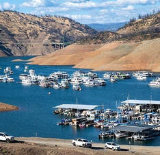 March 4, 2022 Snowpack Survey The Department of Water Resources (DWR) conducted the third snow survey of the season Tuesday at Phillips Station near Echo Summit. Following a January and February that will enter records as the driest documented in state history, the manual survey recorded 35 inches of snow depth and a snow water equivalent of 16 inches, which is 68 percent of average for this location for March. The snow water equivalent measures the amount of water contained in the snowpack and is a key component of DWR’s water supply forecast. Statewide, the snowpack is 63 percent of average for this date. “With only one month left in California’s wet season and no major storms in the forecast, Californians should plan for a third year of drought conditions,” said DWR Director Karla Nemeth. The full snow survey news release can be found on the DWR News page. Governor Gavin Newsom has asked all Californians to cut back water use at least 15 percent compared to 2020 levels. Current water conditions are now available in real time at California Water Watch, a new website launched by DWR. The website will help Californians see their local hydrological conditions, forecasts, and water conditions down to their address or their local watershed. Additional tips on how to conserve can be found at the SaveOurWater webpage. 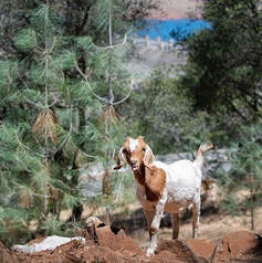 FEATHER RIVER HATCHERY STEELHEAD PLANTING The Feather River Fish Hatchery raised over 630,700 steelhead for release this year. The steelhead were raised for a full year at the hatchery and averaged about 8 to 9 inches in length. Around 129,300 steelhead were released in the Thermalito Afterbay in December 2021 and February 2022. This is a significant increase from normal planting years and will contribute to a more productive recreational fishery. This is a significant increase from normal planting years and will contribute to a more productive recreational fishery. The remaining approximately 501,400 steelhead were released into the Feather River at Boyd’s Pump Boat Launch Feb. 3 to Feb. 18 to meet mitigation requirements. Releasing these young fish further downstream improves their chance of survival. This shortened migration route allows juvenile fish to avoid predators. Steelhead are a salmonid species and are an ocean-going trout. They will migrate from freshwater to marine (ocean), returning to freshwater environments to spawn. They can spawn several times during their lifetime and can live up to eight years. Their “steelhead” name comes from their appearance, a more streamlined shape than Chinook salmon and with a silvery or brassy color as an adult. The Feather River Fish Hatchery is a California State Water Project (SWP) facility built in the late 1960s to mitigate impacts on fish migration resulting from the construction of Oroville Dam which prevented access to spawning grounds further upstream. The Department of Water Resources (DWR) maintains the facility and funds the hatchery operations, fish spawning, rearing, and stocking activities provided by California Department of Fish and Wildlife staff.  DWR SURVEY OF LAKE OROVILLE DWR is conducting a bathymetric (underwater) survey of Lake Oroville to complete a comprehensive topography, or map, of the lakebed. The underwater survey will complement a December 2021 survey that took advantage of the lake’s low water elevations to perform an ‘above water level’ survey of Lake Oroville’s topography, dams, and related structures. Using highly accurate LiDAR remote sensing, the December survey produced precise, three-dimensional information of Lake Oroville’s lakebed. Similar data will be collected from the bathymetric survey. Data from both surveys will provide DWR with up-to-date information that can be used to determine changes in sedimentation, update the reservoir’s storage-stage relationships, and inform future boat ramp extensions. 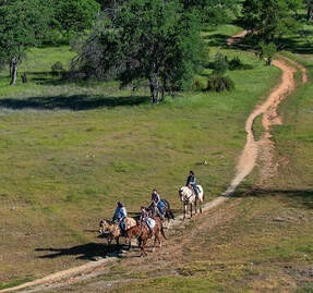 OROVILLE RECREATION
The Loafer Point, Bidwell Canyon, and Lime Saddle boat ramps are open. The Oroville Dam Spillway boat ramp remains closed for repairs. The Foreman Creek and Stringtown cartop boat ramps are also open. Intermittent, short duration closures of the Oroville Dam Crest parking lot may occur to accommodate Lakeside Access Road construction activities. The popular walking/bicycling trail across the top of the dam will remain open and parking will continue to be available at the Upper Overlook. Information on current boat ramp status can be found on the California State Parks’ Lake Oroville State Recreation Area webpage. Scroll down to the link for “Current Launch Ramp Status”. The Lake Oroville Visitor Center is open to the public on Tuesdays, Wednesdays, and Thursdays from 9 a.m. to 5 p.m. Pick up the Lake Oroville Trails Map, which shows more than 97 miles of trails available to equestrians, bicyclists, and hikers, at Lake Oroville State Recreation Area (LOSRA) kiosks, the Oroville Area Chamber of Commerce, and Feather River Recreation and Parks District. The Loafer Creek Recreation Area continues to be closed due to waterline repair (boat ramp and trail access allowed). Visit the California Parks LOSRA webpage for current information on facility status and campground reservations. An interactive map of recreation facilities in DWR’s Oroville-Thermalito Complex is available on DWR’s Lake Oroville Recreation webpage. Information about the 11,000-acre Oroville Wildlife Area is available on the California Department of Fish and Wildlife webpage. CURRENT LAKE OPERATIONS The elevation of Oroville’s reservoir is about 746 feet elevation and storage is about 1.64 million acre-feet, which is 46 percent of its total capacity and 73 percent of historical average. Temperatures over the weekend are forecasted to be in the upper-60s to mid-30s. Next week’s temperatures are forecasted to range between low-70s to low-40s at night. The average daily inflows this week have been around 3,000 cubic feet per second (cfs). Inflows through the weekend and next week are forecasted to be around 3,000 cfs to 3,500 cfs. Inflows are subject to change based upon on actual weather conditions. Total flows to the Feather River are 5,250 cfs. This increase is for downstream water quality and flow requirements. Flow in the low-flow channel through the City of Oroville is 650 cfs and flow through the Thermalito Afterbay Outlet is 4,600 cfs. Releases are assessed daily. The public can track precipitation, snow, reservoir levels, and more at the California Data Exchange Center at www.cdec.water.ca.gov. The Lake Oroville gage station is identified as “ORO”. All data as of midnight 3/3/2022 |
Archives
October 2023
Categories
All
|

 RSS Feed